+254 722 348656


To climb Mount Kilimanjaro on the Rongai route used to guarantee you a quiet trek away from the masses.The Rongai route is marketed as a remote wilderness experience and for much of the year it still isRongai is a moderately difficult route, and is highly recommended, especially for those with less backpacking experience.Rongai route has excellent success rates
Rongai Route Kilimanjaro: Rongai route on mt. Kilimanjaro, Rongai route info, climbing and hiking guide, maps via the first Cave, third Cave, Mawenzi Tarn, Kibo, Horombo hut camps.Climb Africa’s highest mountain via the beautiful Rongai Route, the least demanding and less crowded alternative.
Chat us Live and Contact our Trek advisor
Board Riverside shuttle bus or Impalla shuttle bus from Nairobi airport or city centre at 0800 hrs and proceed to Arusha arriving at 1300hrs. Depart for Moshi at 1400hrs arriving at 1530hrs. Dinner and overnight at a hotel in Moshi or (Pick up from Kilimanajaro airport and transfer to hotel in Moshi)
Distance: 8 km/5 miles
Hiking time: 5 hours
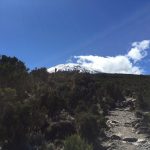
Habitat: Montane Forest
Register at the Marangu park gate with a transfer (approximately 2 ½ hours) to the Rongai trailhead. Meet your guide and porters before you begin your hike from the Nale Moru village. The small winding path crosses maize fields before entering pine forest, and then climbs gently through a forest. The trail is not at all steep, but is rather a gentle hike through beautiful country. The first night’s camp is at First Cave, at about 2,600 metres.
There is a toilet and a wooden table with benches, but no hut. Water can be found just down the trail below First Cave, B,L,D.
Hiking time: 6-7 hours
Habitat: Moorlands
The trail continues up towards Kibo, passing Second Cave (3450m) en-route, and reaching Kikelwa Cave at about 3600 metres. The views start to open up and you begin to feel you’re on a really big mountain! Water is in the obvious stream below the cave, although you might have to wander downhill a way to find some. Overnight at 3rd Cave camp (Kikelewa Caves), B,L,D.
Hiking time: 3-4 hours
Habitat: Moorlands
A short but steep climb up grassy slopes offers superb views of this wilderness area. The vegetation zone ends shortly before you reach your next camp at Mawenzi Tarn spectacularly situated beneath the towering spires of Mawenzi. Spend the afternoon acclimatizing and exploring the area, B,L,D.
Walking distance: 5.5 km/3.5 miles ascent + 15 km/9.5 miles descent
Hiking time: 4 – 5 hours
Habitat: Alpine desert
Continue ascending on the east side of Kibo crossing the saddle between Mawenzi and Kibo taking 4 to 5 hours to reach Kibo Hut. The remainder of the day is spent resting in preparation for the final ascent, which begins around midnight. Overnight at Kibo Camp, B,L,D
Distance: 6 km’s ascent – 21 km’s descent
Hiking time: 8 hours to reach Uhuru, 6 hours to descend to Horombo
Habitat: Stone scree and ice-capped summit
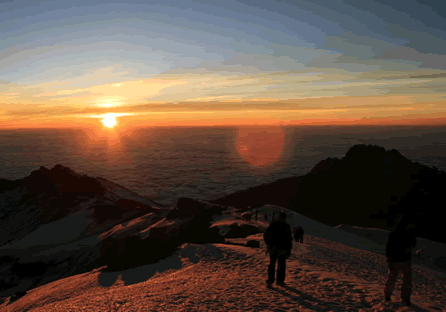
You will rise around 23h30, and after some tea and biscuits you shuffle off into the night. This is where the going really gets tough. The first section of the trail consists of a rocky path to the Hans Meyer Cave (5150m), also a good resting spot. The path then zigzags up to Gillman’s point (5 681m), which is located on the crater rim. This section is very steep with a lot of stone scree, requiring a great physical and mental effort. Probably the most demanding section of the entire route. Do the Kili shuffle and move slowly.
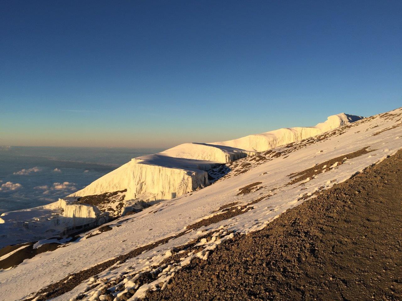
From Gillman’s Point you will normally encounter snow all the way up to Uhuru peak (5895m), the highest point in Africa. Total exhilaration and satisfaction – you made it. Weather conditions on the summit will determine how long you can spend, taking photographs, before the 3-hour descent back to Kibo hut. After a short rest you gather all your gear for the ascent and head down to Horombo hut (3 hours) where you will overnight. The return to Horombo hut will seem surprisingly fast compared to the ascent. The total time spent walking on this day is around 14 hours, so be prepared for a very tough day. Later in the evening you enjoy your last dinner (with soft drink and beer for sale at the camp office) on the mountain and well-earned sleep, filled with memories and stirring emotions, B,L,D.
Distance: About 27 km’s
Hiking time: 6 hours
After breakfast you continue your descent (6 hours), passing the Mandara hut, down to the Marangu gate. At Marangu gate you sign your name and details in a register. This is also where successful climbers receive their summit certificates. Those climbers who reached Gillman’s Point (5685m) are issued with green certificates and those who reached Uhuru Peak (5895m) receive gold certificates. You now drive back to Moshi for a long overdue hot shower, Overnight in the Hotel. B/B
Shuttle transfer/airport Transfer or safari